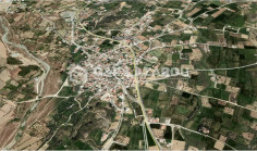
Huge (59.571 sq.m) Agricultural &Residential Land in Pera village. It has an irregular shape and covered by all utility srvices (water,electricity and telecomunication).
The property is a shared (20%) agricultural field in Pera Orinis. It is located 5,5 km from the village centre. Its southeastern and part of its northeastern boundaries are adjacent onto Pera and Tseri borderline. The field has a total land area...
The property is a shared (20%) agricultural field in Pera. It is located 2.7km from Tseri. It has a total land area of 9,700sqm and Gordian’s share corresponds to 1,940sqm.
The property relates to an agricultural field in Pera Oreinis. It is located 90m from Pera-Kampia main road and 2.2km from Pera Oreinis Village. It abuts to a registered dirt road on its east boundary and it has a total land area of 9,365 sqm. The...
The property concerns two agricultural fields in Pera Oreinis. It is located 90m from Pera-Kampia main road and 2km from Pera Oreinis Village. The property has a total land area of 14,048sqm and it abuts to a registered dirt road on its east...
The property is an agricultural field in Pera. It is located 3,5km from Analiontas and 4km from Tseri. The property abuts to a registered road, on its southeast boundary with a total frontage of 14m. It has a total land area of 13,543sqm.
The property is an agricultural field located in Pera Oreinis Village, Nicosia District. It is located 450m of Pera - Psimolofou main road and 3,5km of Pera Oreinis Village. The property is situated 450m of the nearest registered road. It has a...
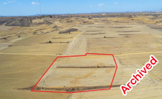
The asset is a field in Pera. The field is located from Pera centre and Tseri - Analiontas road. It has a rectangular shape and even surface. It lies 120m from a public road.
The asset is a field in Pera. It is located 300m from the road that connects Ergates and Tseri and 3km from the center of the village. The field has an area of 4,014sqm. It has a flat surface and it lies 90m north from a public road.
The asset is a field in Pera. It is located 300m from the road that connects Ergates with Tseri and 3km from the center of the community. The field has an area of 3,679sqm with a flat surface. It lies 90m from the nearest public road.
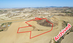
Located in Pera, approximately 800m south of the main road Kampia- Analiontas. The immediate area is characterized by vacant land. -Irregular shape and uneven surface. -Olive trees -Adjacent to a river. -Just 800m away from the nearest registered...
✔Located approximately 670m south of the main road Kampia-Analiontas and 1.8km west of Analiontas village. ✔Trapezoid shape and a slightly sloped surface ✔Adjacent to government land ✔ Just 100m from nearest registered road at its the...
two fields are located approximately 650m southeast of the centre of Kampia village -The nearest registered road is 350m. -The fields have an irregular shape and a slightly sloping surface. -Field with registration number 0/17569 has an area of...
Agricultural land in Pera village. It falls within agricultural planning zone Γ3 with 10% building density, 10% coverage, 2 floors and a maximum height of 8,3m. Subject to VAT.